 Incident
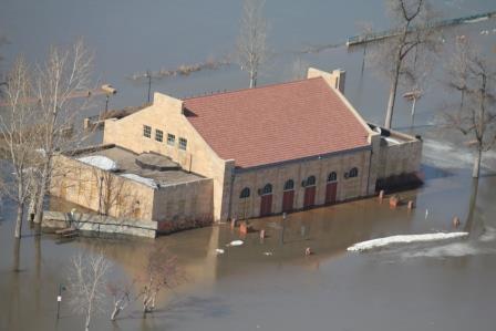
Severe storms and spring flooding along the Red, Minnesota, Mississippi, St. Croix Rivers and their tributaries.
Incident Period
March 16, 2011 - May 25, 2011
Presidential Declaration Date
May 10, 2011 Public Assistance and Hazard Mitigation
FEMA ID Number
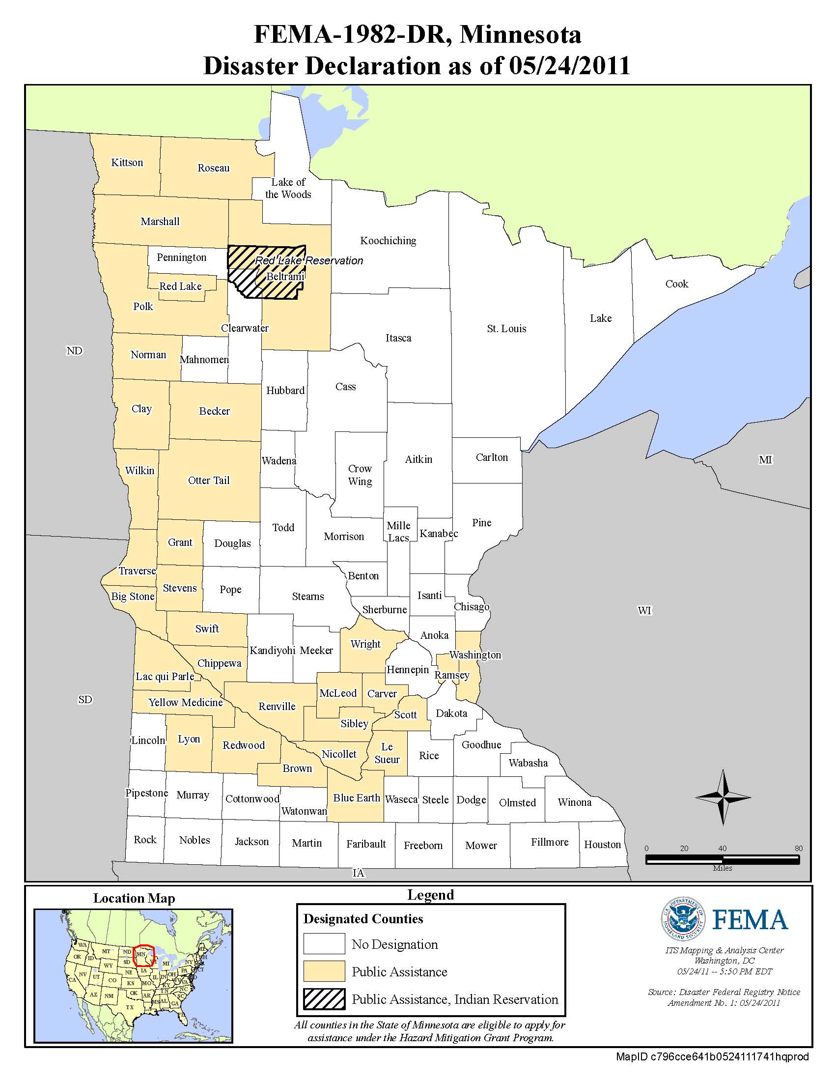
Counties Declared
Becker, Beltrami, Big Stone, Blue Earth, Brown, Carver, Chippewa, Clay, Grant, Kittson, Lac qui Parle, Le Sueur, Lyon, Marshall, McLeod, Nicollet, Norman, Otter Tail, Polk, Ramsey, Red Lake, Redwood County, Renville, Roseau, Scott , Sibley, Stevens, Swift, Traverse, Washington , Wilkin, Wright, and Yellow Medicine.
Tribal Governments
Red Lake Nation
For more information regarding local recovery activity and assistance for this incident please contact the specific county or tribal emergency manager.
Disaster-related Fatalities
2
Total Cost Estimate
$27,793,940 (as of 1/3/2013)
The FEMA Public Assistance Program is a 75 percent reimbursement program
The State of Minnesota is funding 100 percent of the non-federal share for this disaster declaration
Minnesota State Funding
Omnibus Tax Bill 2011, Article 10, Section 5 - Appropriation for disaster relief
Appropriated $9,000,000 to provide a match for FEMA disaster assistance to state agencies and political subdivisions for disaster recovery work related to the spring 2011 floods (DR-1982), the May 22, 2011, tornadoes in Hennepin and Anoka Counties(DR-1990), and the July 2011 tornadoes (DR-4009). $5,000,000 of the appropriation is reserved for the area of the spring flooding. Any unexpended portion of a 2010 appropriation to the Department of Agriculture for disaster assistance may be transferred to the Commissioner of Public Safety if it is needed to supplement the $9,000,000 appropriation.
Current Status
It is estimated that all applicants will receive their initial payments by March 2012. All costs will be estimates until the final closeout is complete.
Event Summary
Heavy late summer and autumn 2010 precipitation (twice the normal amount since October 2010 in parts of Minnesota) left soils saturated and river levels above normal prior to the winter freeze. The winter preceding the flood was the 4th snowiest on record. National Weather Service (NWS) reported that the snowpack contained a water content ranked among the highest in the past 60 years.
The NWS spring outlook for the Red River, released in January 2011, indicated that much of the southern basin had a higher risk of flooding than experienced in the 2006 and 2010 major flood events.
Preparations for this event began in early January with meetings between the NWS, North Central River Forecast Center, and state agencies. Regional flood briefings were held statewide the first week in February. On February 14, Moorhead became the first city to declare a local emergency. An additional 54 communities declared local emergencies in the following two months.
On January 25, Governor Dayton requested contingency planning assistance (Advance Measures) from the U.S. Army Corps of Engineers (USACE). USACE began providing technical support to communities along the major river systems (Red, Minnesota, Mississippi and St. Croix) on February 15.
On March 27, the Minnesota River began to crest at major flood levels in New Ulm and remained for 19 days. On March 27, Montevideo also reached major flood stage and did not fall below that until April 15.
The Mississippi River basin began to crest in Delano on March 20 recording its 4th highest crest on record. On March 29, St. Paul experienced an initial crest on March 29 and a secondary crest on April 11.
The Red River reached major flood stage in Moorhead on April 6 and crested 4 days later recording its 4th highest crest on record. On April 12 and 13, the Red crested in East Grand Forks and Halstad recording their 3rd highest crest on record.
Map